


GARMIN GPSMAP 67
€599.99
Take time for your adventures and explore nature with the rugged GPSMAP 67. Thanks to long battery life, multi-frequency reception for precise positioning, and pre-installed TopoActive Europe maps, you are optimally equipped.
1 in stock
DISCOVER THE WORLD
Take time for your adventures and explore nature with the robust GPSMAP 67. Thanks to a long battery life, multi-frequency reception for precise positioning and pre-installed TopoActive Europe maps, you are optimally equipped.
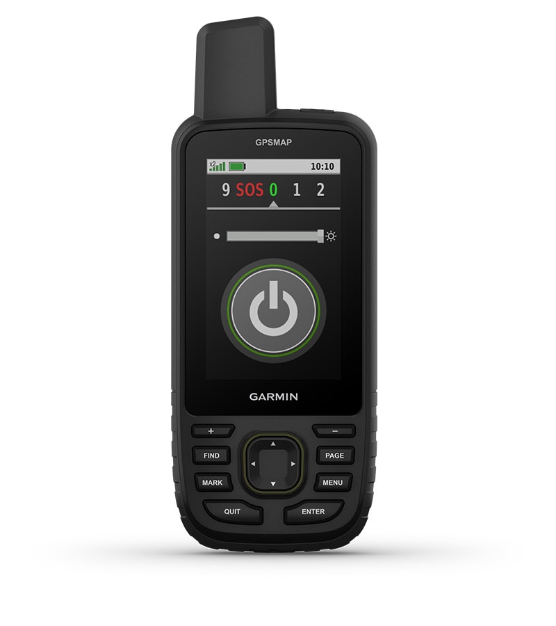
The 3-inch color display is easy to read even in sunlight, so you can see your route clearly.
Stay on the go longer with up to 180 hours of battery life in tracking mode and up to 840 hours in expedition mode.
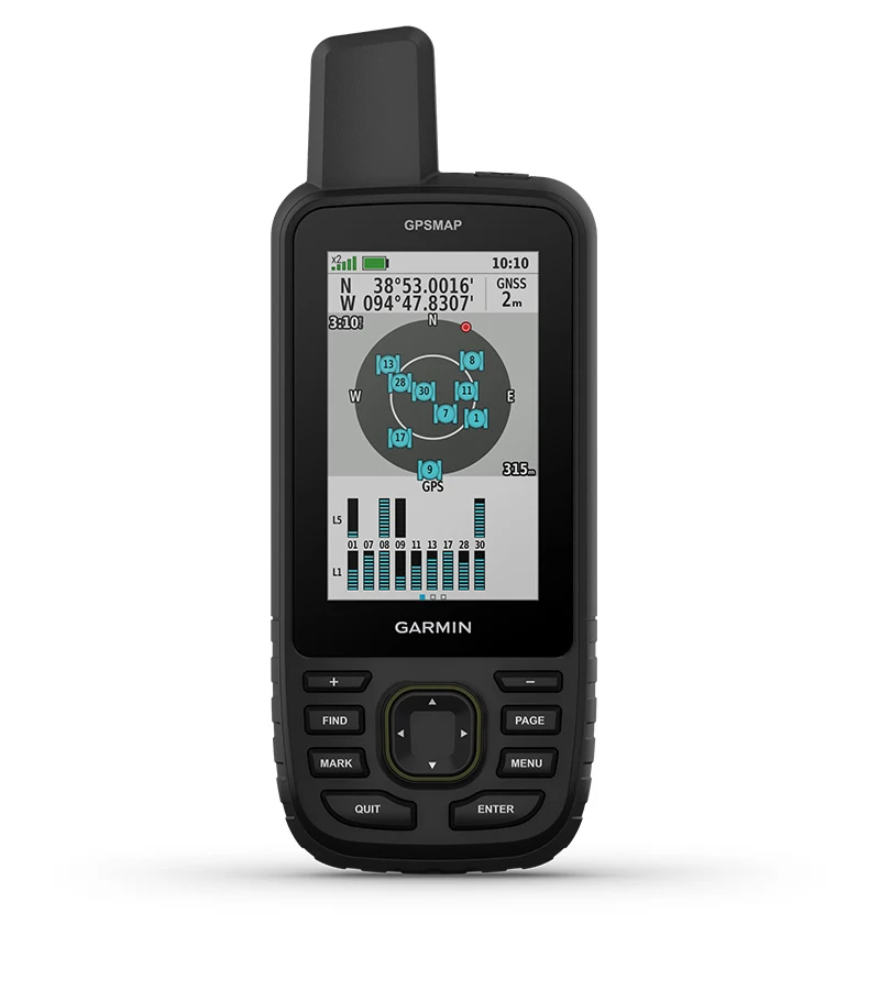
Thanks to several global satellite systems and multi-frequency reception, your positioning is absolutely precise.
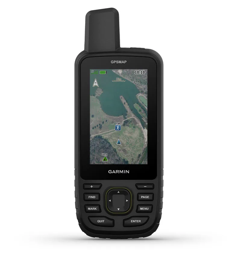
See the terrain of your route on clear satellite images downloaded directly to your handheld device.
Stay informed about the conditions with real-time weather forecasts. Simply pair the device with your compatible smartphone.

Discover new favorite places.
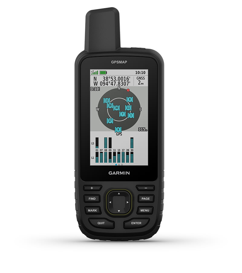
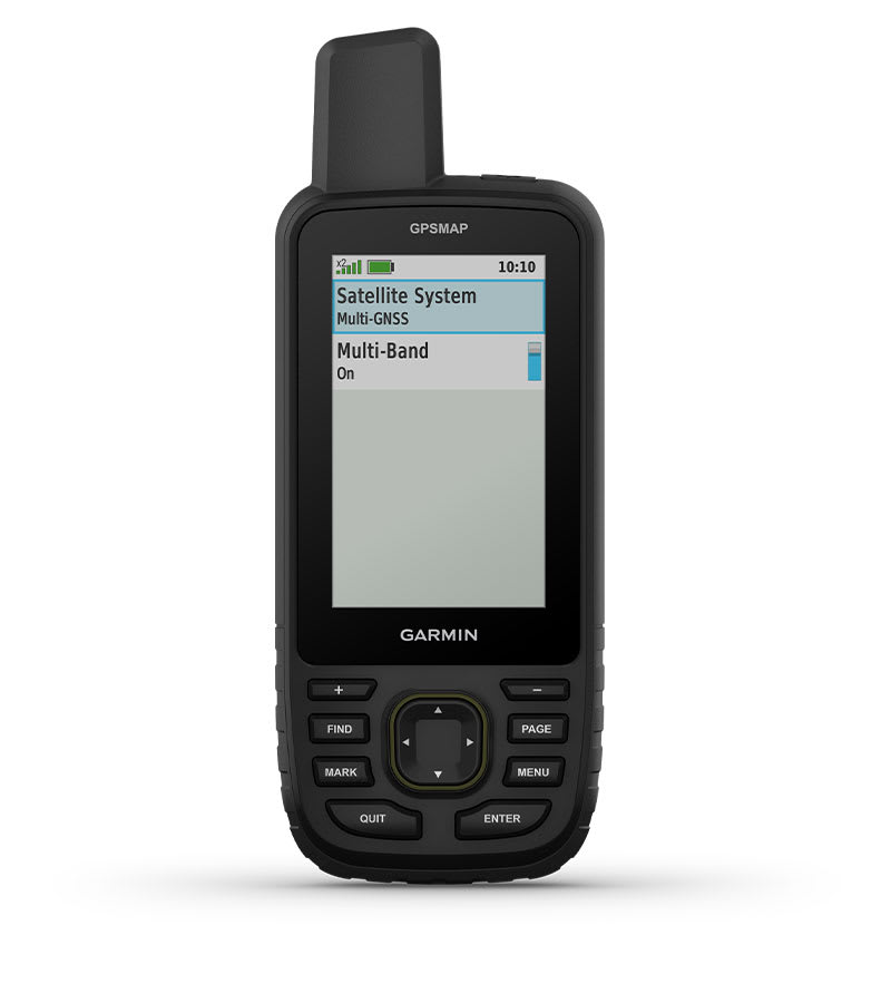
MULTI-FREQUENCY RECEPTION
Use multiple global satellite systems (GPS, GLONASS, Galileo and QZSS). Access different frequencies to increase positioning accuracy in areas where GNSS signals are bounced, weak or usually unavailable.
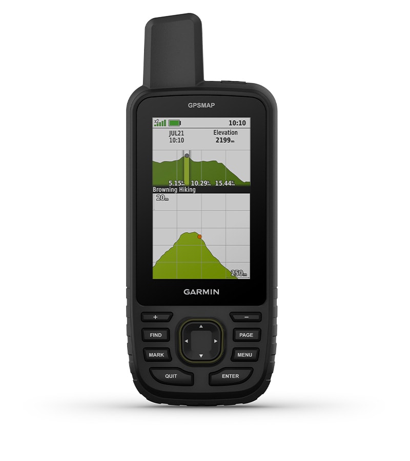
ABC SENSORS
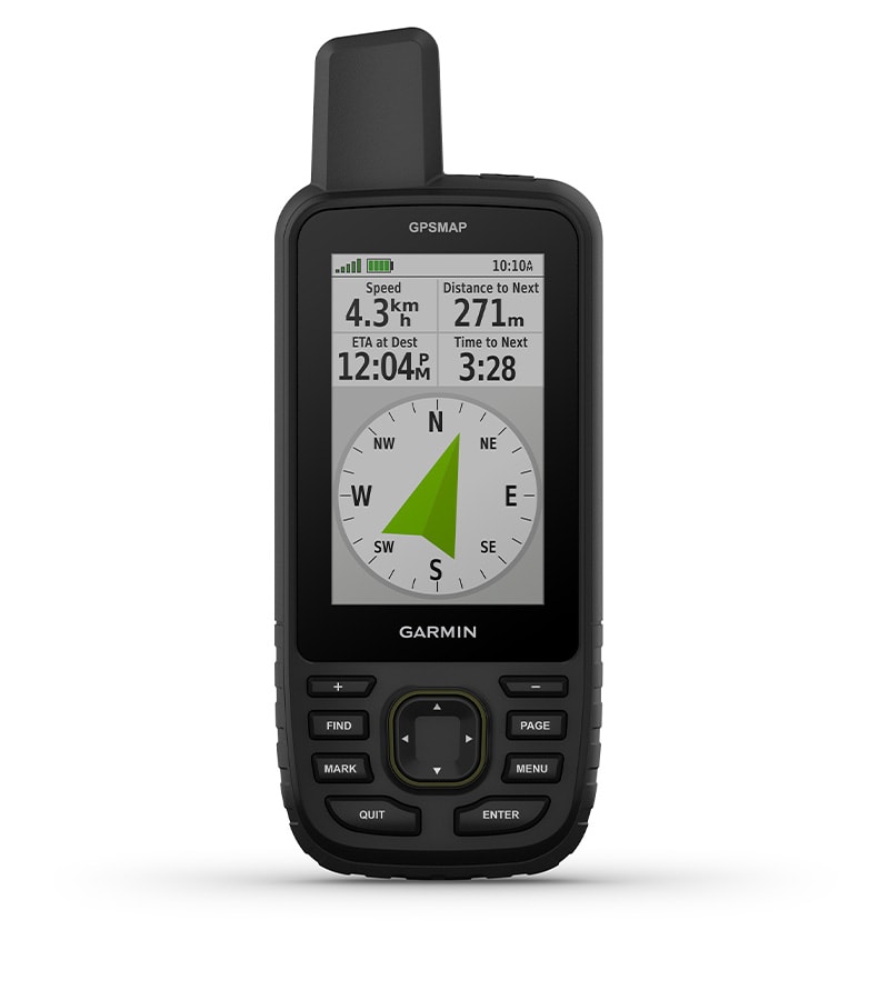
Navigate any trail with ABC sensors, including an altimeter for elevation data, a barometer to monitor the weather, and a 3-axis electronic compass.
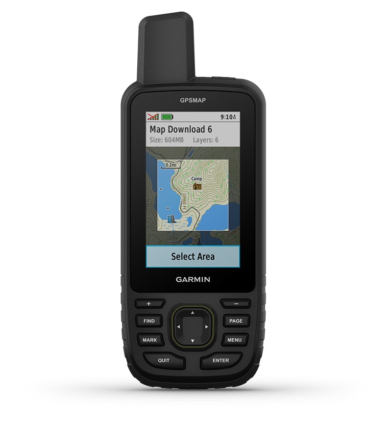
SATELLITE IMAGES
Download high-resolution, photorealistic satellite images directly to your GPSMAP via Wi-Fi. Easily find trails, search for parking, create waypoints and more
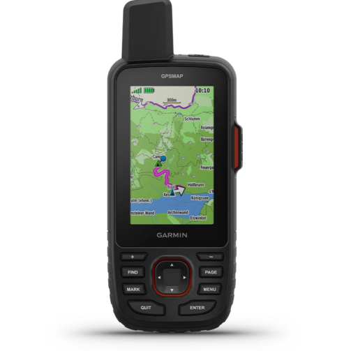
TOPOACTIVE EUROPE MAPS
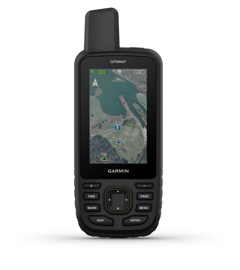
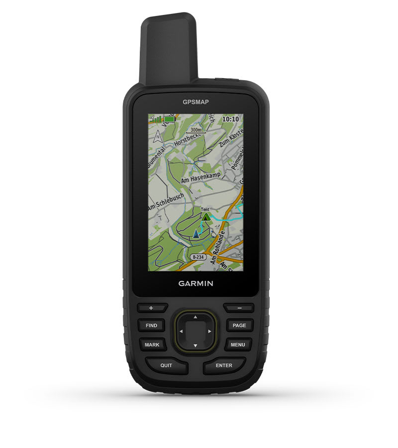
Pre-installed TopoActive Europe maps show you where peaks, parks, coastlines, rivers, lakes and geographical points are located.
PREMIUM CARD FEATURES
With an Outdoor Maps+ subscription, you get access to public land information, landowner names, state zoning maps, hunting management area boundaries, BLM boundaries, and more 1 .

On the road for days.
MADE FOR EVERY ADVENTURE
This handheld device is designed to military standards (MIL-STD-810) for thermal performance, shock resistance and water resistance and is even compatible with night vision goggles.
LED FLASHLIGHT
The GPSMAP 67 series helps you keep your equipment to a minimum. One example is the integrated LED flashlight, which can also be used as an auxiliary beacon.
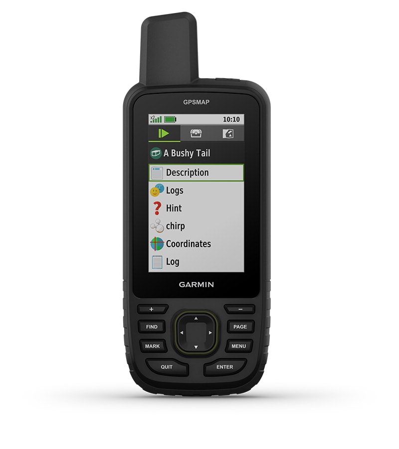
GEOCACHING – FIND THE TREASURE
Get automatic cache updates from Geocaching Live, including descriptions, logs and tips. Every geocache you find is uploaded to your Geocaching.com profile via Wi-Fi or the Garmin Explore ™ smartphone app .
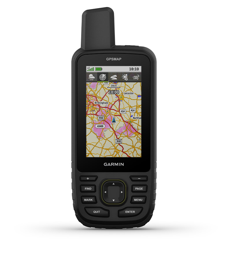
INDIVIDUAL WEATHER DATA
When connected to the Garmin Explore smartphone app, you can view real-time weather forecasts so you always know when conditions are changing.
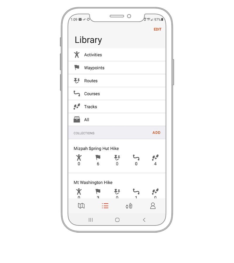
GARMIN EXPLORE ™ APP
Use the Garmin Explore website or app for navigation, waypoints, courses, activities and collections. Plan your next trip by downloading maps and creating routes. You can even view completed activities on the go.
LONG BATTERY LIFE
The integrated lithium-ion battery provides a runtime of up to 180 hours in GPS mode and up to 840 hours in expedition mode.
Reviews
There are no reviews yet.