

GARMIN GPSMAP 65s
€449.99
Robust handheld device with multi-frequency technology for optimal tracking accuracy, 5 satellite systems, 2.6-inch color display and pre-installed maps.
1 in stock
DISCOVER THE BIG WIDE WORLD.
Robust outdoor handheld device with multi-frequency technology for optimal tracking accuracy, 5 satellite systems, 2.6 inch color display and pre-installed maps.
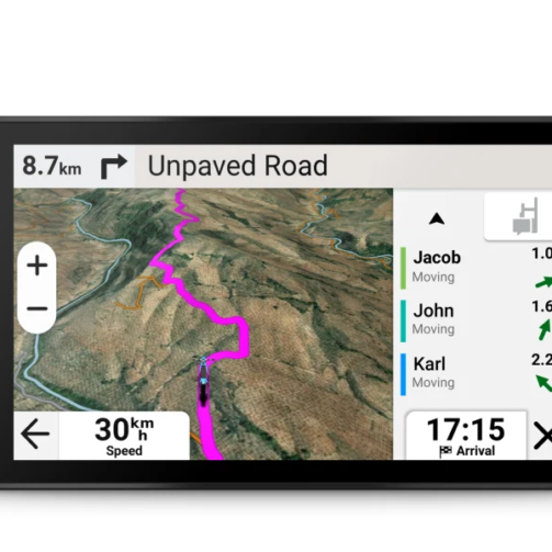
You won’t miss any detail on the large color display, which is easy to read even in sunlight.
Thanks to multi-frequency technology and multi-satellite systems, you can find your way anywhere.
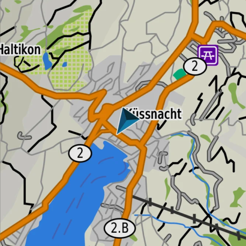
Cross the country with the pre-installed, routable TopoActive Europe maps.
The barometric altimeter and 3-axis compass ensure ideal orientation.
Organize your adventure anywhere with the Garmin Explore ™ website and app 1 . Explore even more.
With a battery life of up to 16 hours in GPS mode, you are ready for long tours.

DISCOVER NEW THINGS.
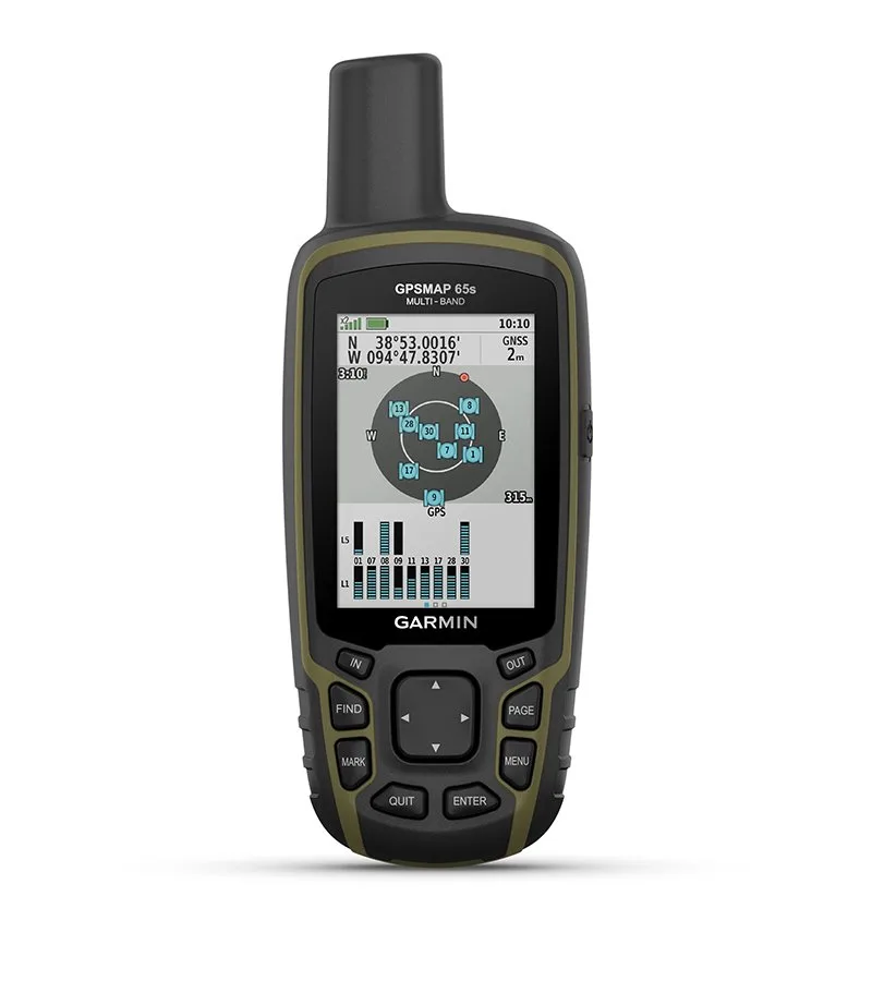
PERFECT LOCATION DETERMINATION
Multi-frequency technology and advanced multi-satellite support (GPS, GLONASS, Galileo, QZSS and IRNSS) provide optimal accuracy in steep terrain, between high-rise buildings and in densely treed forests.
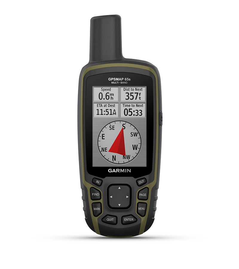
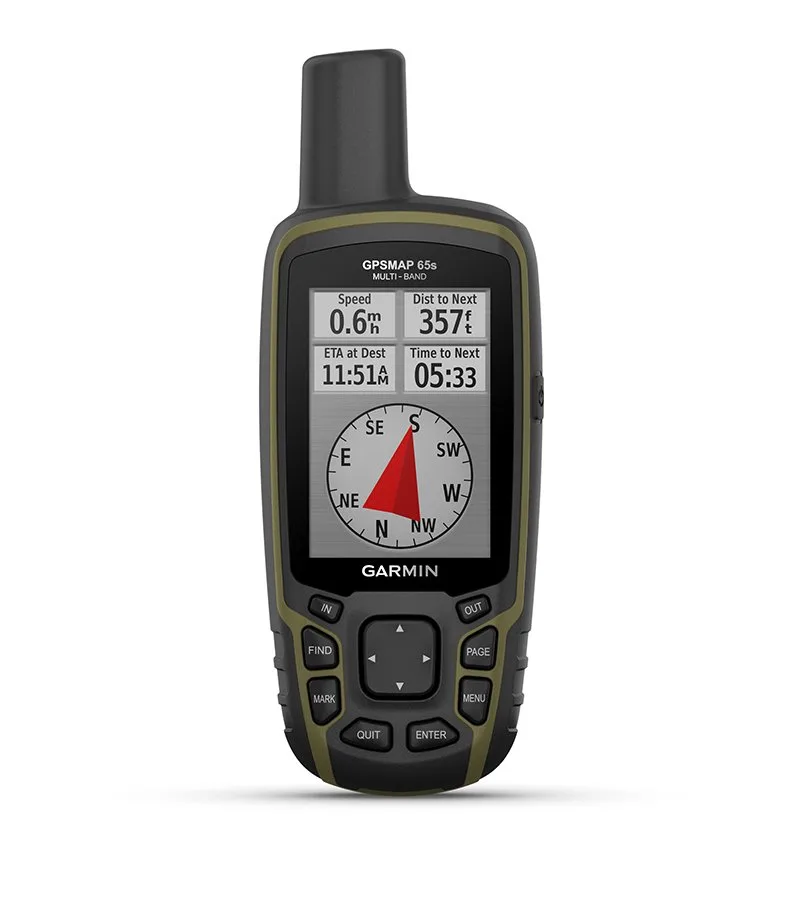
COMPASS AND BAROMETER
Navigate any trail with ABC sensors, including an altimeter for elevation data, a barometer to monitor the weather, and a 3-axis electronic compass.
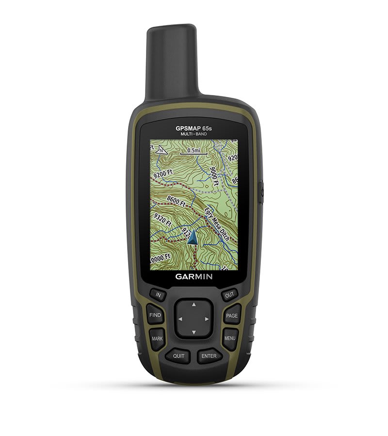
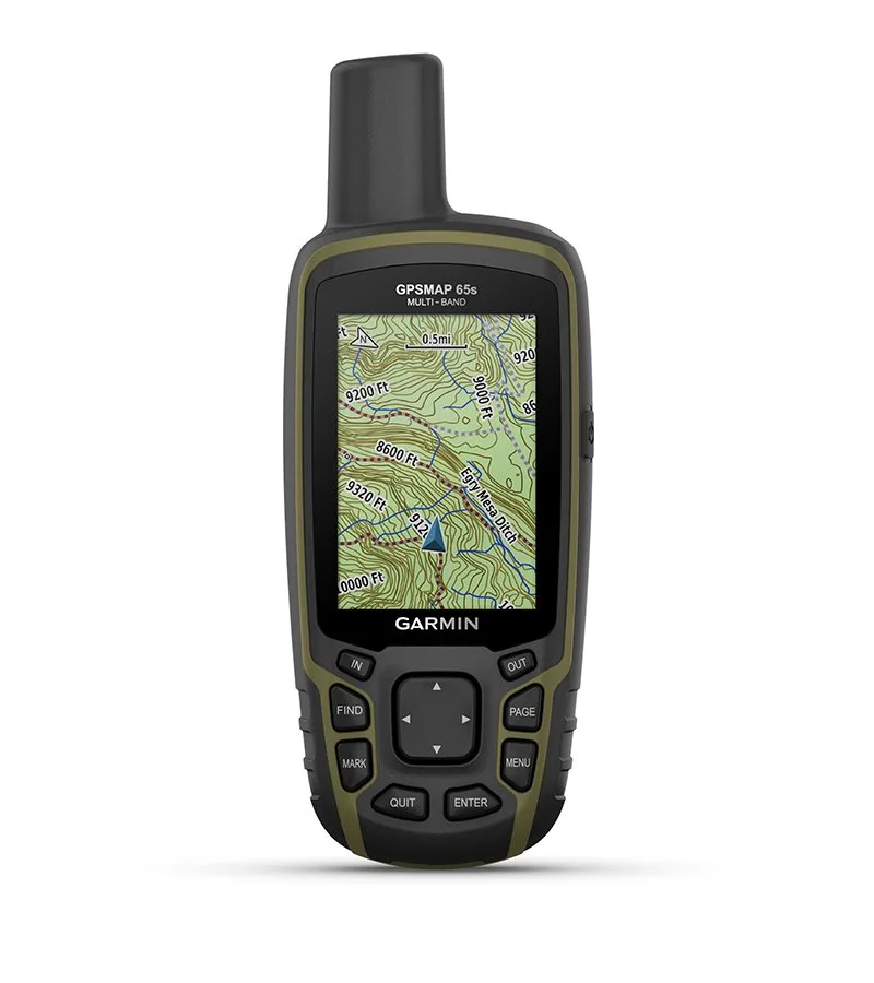
PRE-INSTALLED EUROPE MAPS
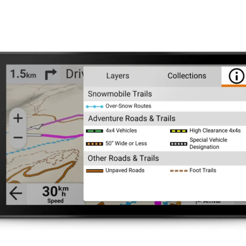
Preloaded TopoActive Europe maps provide detailed views of routable roads and off-road routes, waterways, natural features, land use areas, buildings and more.
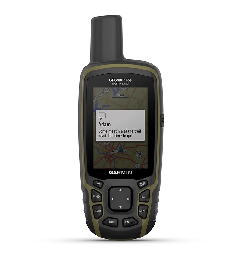
PHONE NOTIFICATIONS
Receive emails, SMS messages and alerts directly on your handset display when paired with a compatible device.
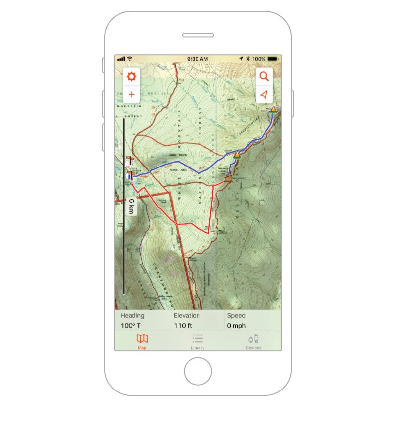
GARMIN EXPLORE-APP
Use the Garmin Explore app 1 and website to plan, view and sync waypoints, routes and tracks. You can even view completed activities on the go.
GEOCACHING – FIND THE TREASURE
Get automatic cache updates from Geocaching Live, including descriptions, logs, and tips. Start hunting right away. Let’s go.
MICROSD ™ SLOT
Use your compatible device and a microSD memory card to download TOPO 24K maps and hit the trail, or access HuntView Plus maps to view public land types and boundaries, as well as the names of private landowners and their land boundaries.
Related Products

Reviews
There are no reviews yet.